
Geographic Information Systems (GIS) Course
Wouldn’t you like to secure an exceptional job opportunity that guarantees you an excellent monthly income and substantial annual returns with a variety of job benefits? The Geographic Information Systems (GIS) course ensures you gain valuable knowledge that will allow you to work in this field with ease and simplicity. Here’s your chance to take a course that lasts no more than 20 hours, divided into several lectures to make studying easier. Don’t miss this opportunity and set yourself up for a professional and high-level career path.
There is a special discounted price for students and graduates for the complete GIS course. Contact us via WhatsApp for more details for free from ZFuture Consulting & Training.
Contents of the GIS Course
If you are looking for a GIS course, we offer one of the most powerful training courses you can attend. It includes comprehensive content that ensures you earn your certificate with full merit and entitlement. The content covered in the course includes:
- Key elements handled in GIS.
- What is GIS (Geographic Information Systems)?
- Components of GIS.
- Key applications of GIS.
- How GIS is used to solve environmental issues.
What is a Full GIS Course?
The GIS course is a training program designed to introduce all participants to the principles and techniques of Geographic Information Systems. These systems are used for analyzing different geographical data, as well as managing maps and other information. The course covers both basic and advanced professional GIS topics.
What’s the Difference Between GIS and GPS?
If you’re wondering about the difference between GIS and GPS, there are several distinctions, not just one. We’ll explore these differences in detail in the next sections.
Difference Between GIS and GPS in Definition:
- GIS (Geographic Information Systems) is a system used for collecting, analyzing, managing, and displaying geographical and spatial data. It’s widely used to create maps and analyze relationships between different geographic locations.
- GPS (Global Positioning System), on the other hand, is a technology that relies on satellites to precisely locate any point on Earth’s surface.
Tools Used in GIS and GPS:
- GIS relies on specialized software like ArcGIS or QGIS, and sometimes databases are used to store and analyze large amounts of geographical data.
- GPS relies on receivers such as smartphones or handheld devices that receive signals from satellites to pinpoint a location.
Uses of GIS and GPS Systems:
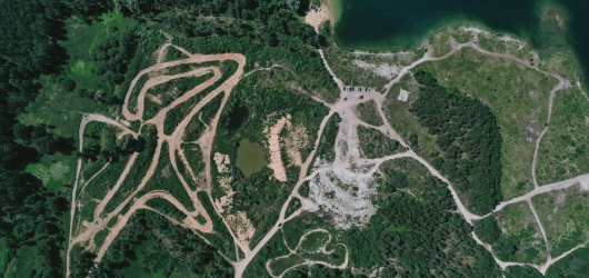
- The GIS course is highly effective due to the extensive use of this system. It is a powerful tool for analyzing environmental and geographical data. GIS is used to understand environmental changes, study the factors affecting the availability of natural resources, and play a vital role in disaster management by identifying affected areas and creating effective response plans.
- Furthermore, GIS is used in urban planning to distribute services and facilities optimally, analyze population density, and study infrastructure in detail. GIS also plays an important role in creating complex maps that include diverse data such as population distribution and topography, aiding in informed decision-making in various sectors.
On the other hand, the GPS system is one of the most essential tools in various navigation operations. It is used to guide cars, planes, and ships to their desired destinations accurately. GPS is also used to track individuals and vehicles and is relied upon for measuring distances and altitudes, especially in sports activities, enhancing the user’s experience in accurately determining their location.
What is an Information Systems Course?
An Information Systems course is a distinguished training program aimed at introducing participants to the concept of Information Systems, which involves the design, management, and development of systems that combine technology, data, and people to support organizational processes and decision-making. The course includes studying how to store, process, and use data to achieve business objectives.

Fundamentals of Geographic Information Systems (GIS)
The fundamentals of Geographic Information Systems (GIS) management refer to a set of basic concepts and tools that form the foundation of GIS science. GIS is used to link data with geographic locations and analyze the relationships between them. The basics include the following:
- Concept of Geographic Information Systems (GIS): Understanding what GIS is and its role in spatial data analysis.
- Managing Different Work Methods: Learning how to handle various GIS methods and workflows effectively.
- Reading Metadata Accurately: Gaining the ability to interpret and understand metadata related to spatial data.
- Analyzing Geographic Data: Developing skills to analyze geographic data and extract valuable insights.
- Familiarity with Hardware Components: Understanding the internal components and devices used in GIS systems.
- Understanding Software and Its Usage: Knowing how GIS software works and how to interact with it efficiently.
- Applications of GIS in Various Fields: Exploring the many ways GIS can be applied in different industries and sectors.
- Analytical Tools: Using tools for spatial analysis, including queries and detailed spatial analysis, as well as map design.
Applications of Geographic Information Systems (GIS)
Obtaining a GIS course is highly essential due to the widespread use of Geographic Information Systems across various fields in daily life. GIS plays a significant and influential role, and the more proficient you are in using this system, the higher your chances of securing a prestigious and impactful job in society. Below are some of the key applications of GIS:
- Monitoring Water, Forests, and Soil: Tracking and managing water resources, forest health, and soil conditions.
- Border Surveillance and Security Risk Analysis: Analyzing security risks and monitoring border areas.
- Market and Site Analysis for Businesses: Identifying ideal locations for businesses and analyzing market trends.
- Monitoring Climate Change and Biodiversity: Studying environmental changes and monitoring biodiversity.
- Improving Road Networks and Route Planning: Enhancing road infrastructure and optimizing transportation routes.
- Disaster Response and Emergency Planning: Identifying affected areas and planning effective responses for emergencies and disasters.
- Locating Health Centers and Analyzing Disease Spread: Identifying locations for healthcare facilities and analyzing the distribution of diseases.
- Designing Maps for Tourist Attractions and Visitor Flow Analysis: Creating maps for tourist destinations and studying visitor patterns.
- Improving Agricultural Production: Analyzing soil conditions and climate factors to enhance agricultural productivity.
- City Planning and Service Distribution: Designing urban areas and allocating services based on the needs of the population.
With GIS, you can contribute to better decision-making, planning, and sustainability across a wide range of industries.
Most Common GIS Software Programs
During your training in the GIS course, you will learn how to work with the various software programs used in Geographic Information Systems (GIS). There are many programs you will need to familiarize yourself with in order to work with them easily and efficiently. Below are some of the most important software programs that you will learn with us:
- ArcGIS
- QGIS
- Google Earth Pro
- MapInfo Professional
- AutoCAD Map 3D
- ERDAS IMAGINE
- GRASS GIS
- GDAL
- GeoServer
- PostGIS
Frequently Asked Questions About the GIS Course
1. Does a GIS Diploma Lead to a Good Salary?
Absolutely! Earning a GIS diploma can lead to lucrative job opportunities, especially in sectors that heavily rely on geographic data analysis. Salaries vary based on several factors, including geographic location, level of experience, the industry, and the size of the company.
In industries such as urban planning, natural resource management, environmental consulting, and government positions, there is a high demand for GIS specialists, often leading to better salaries compared to many other fields.
2. Does the GIS Field Have a Promising Future?
Yes, the GIS field has a bright future and is considered one of the rapidly growing sectors due to:
- Its widespread use in government sectors.
- The growing reliance on geographic data.
- Its crucial role in sustainability issues adopted by major countries.
- Increasing dependence on geographic data across industries.
- Availability of diverse job opportunities in tech companies and environmental organizations.
- Continuous advancements in satellite technology and mobile devices.
- High demand in areas such as urban planning, natural resources, and environmental science.
- Integration with technologies such as Artificial Intelligence, Machine Learning, and Big Data.
ZFuture Consulting and Training Company offers a variety of training courses, including:
- Occupational Health and Safety Course
- Sustainable Development Course
- Carbon Footprint Course
- Environmental Impact Assessment Course